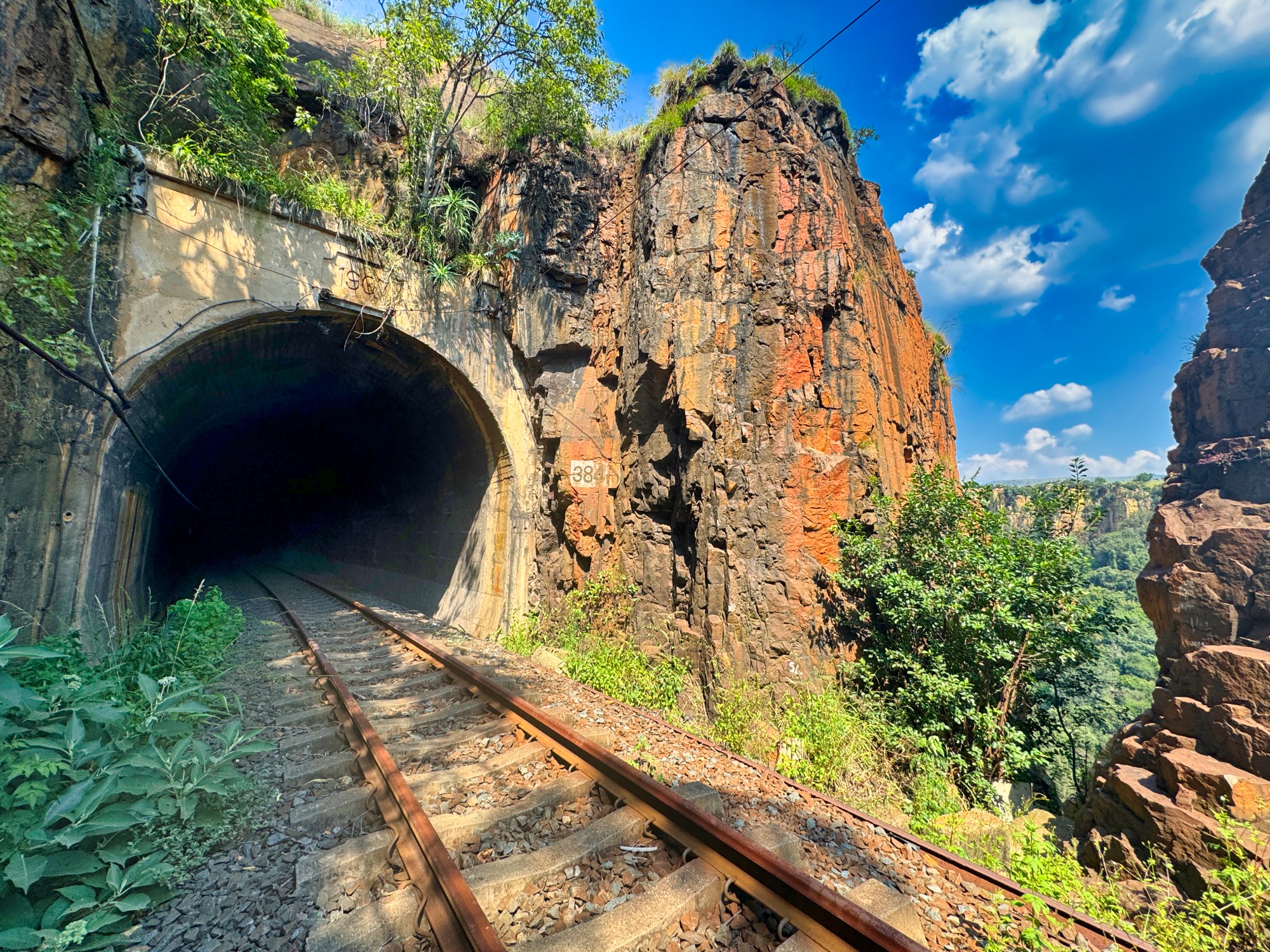
Waterval Boven
Waterval Boven, also known under the changed name Emgwenya, located near Johannesburg in South Africa, is definitely the most famous spot for sport climbing in all of Africa. Despite this status, it seems that its popularity, compared with other well-known places around the world like Tonsai, Siurana, or Geyikbayırı, is not too high, and even within South Africa itself, Boven appears to definitely lag behind the bouldering popularity of Rocklands.
Rock and Climbing
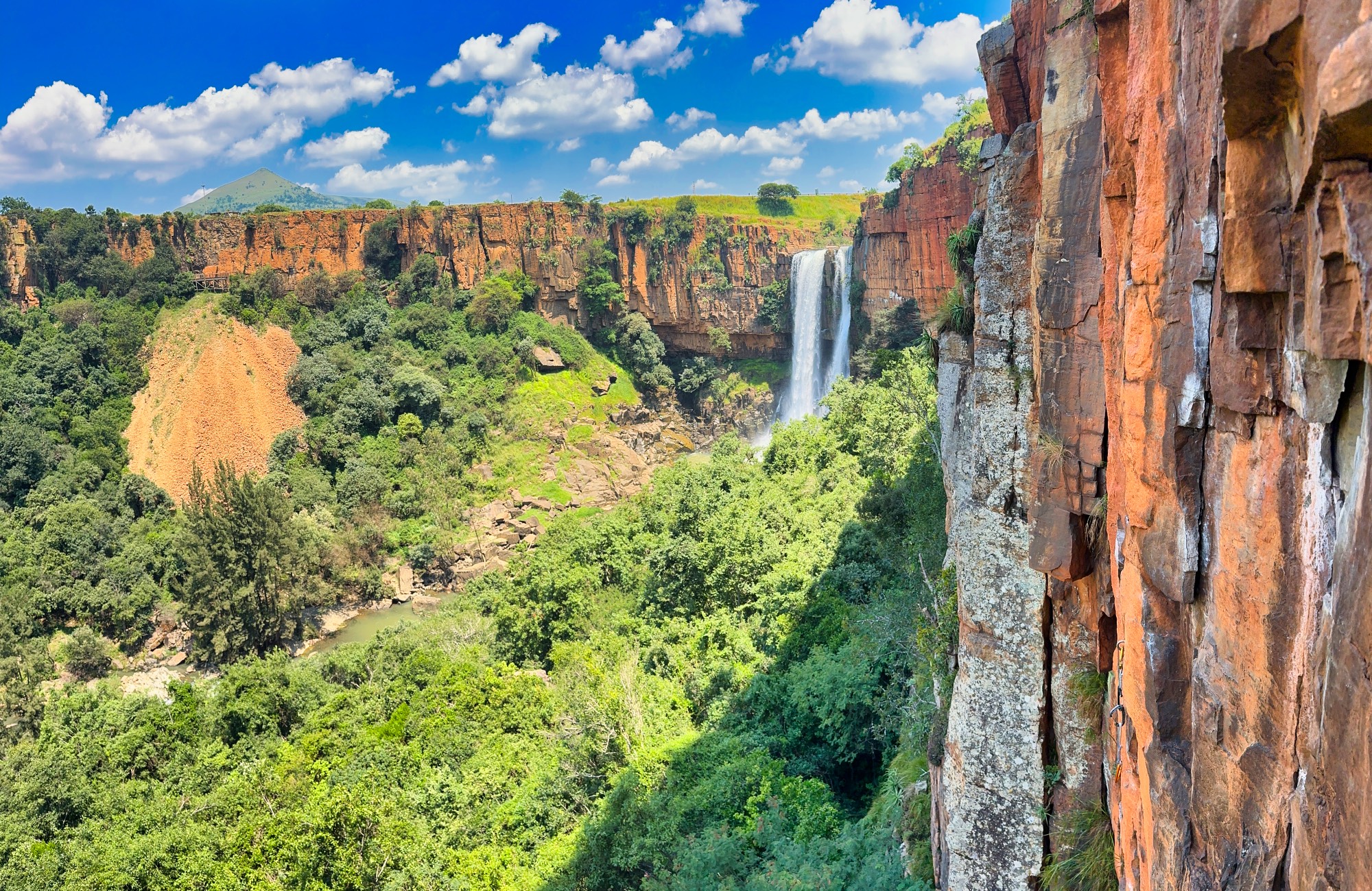
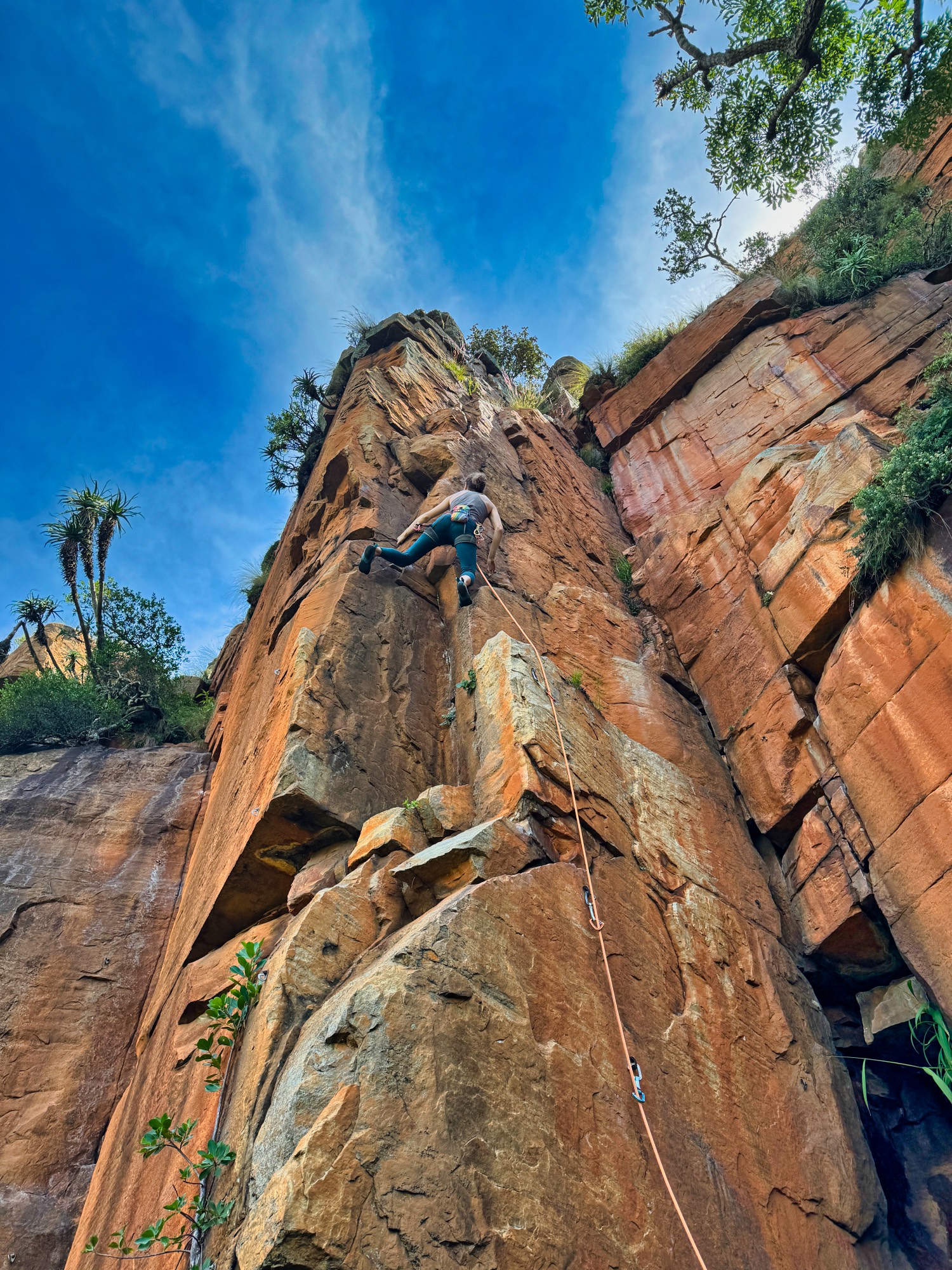
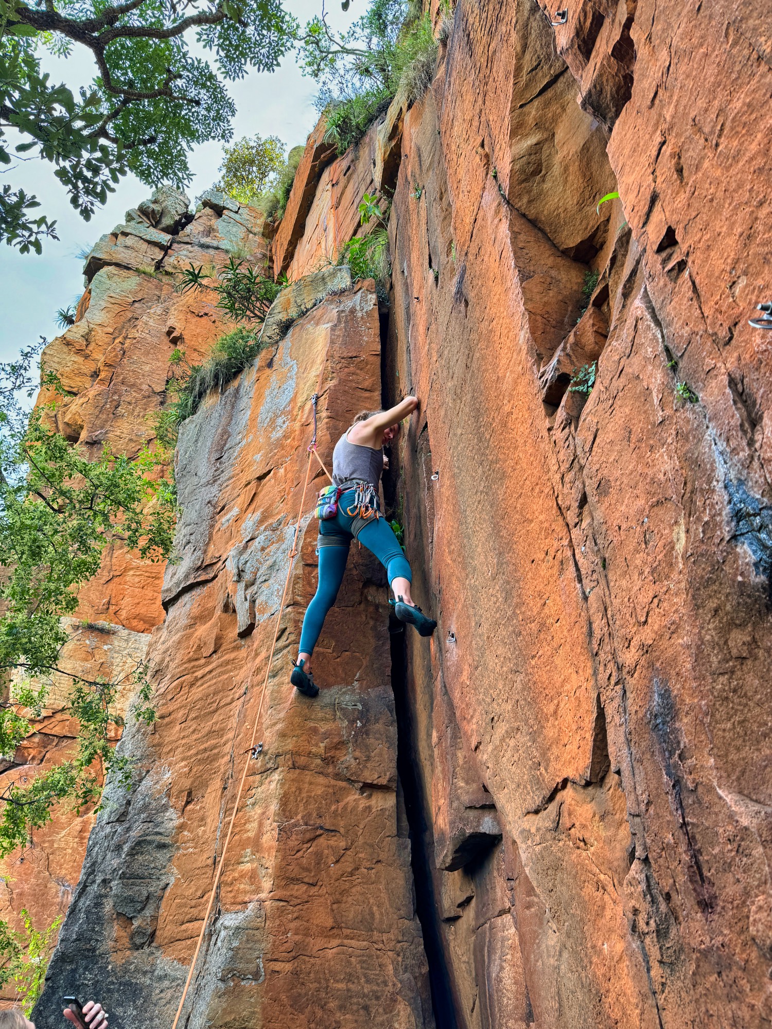
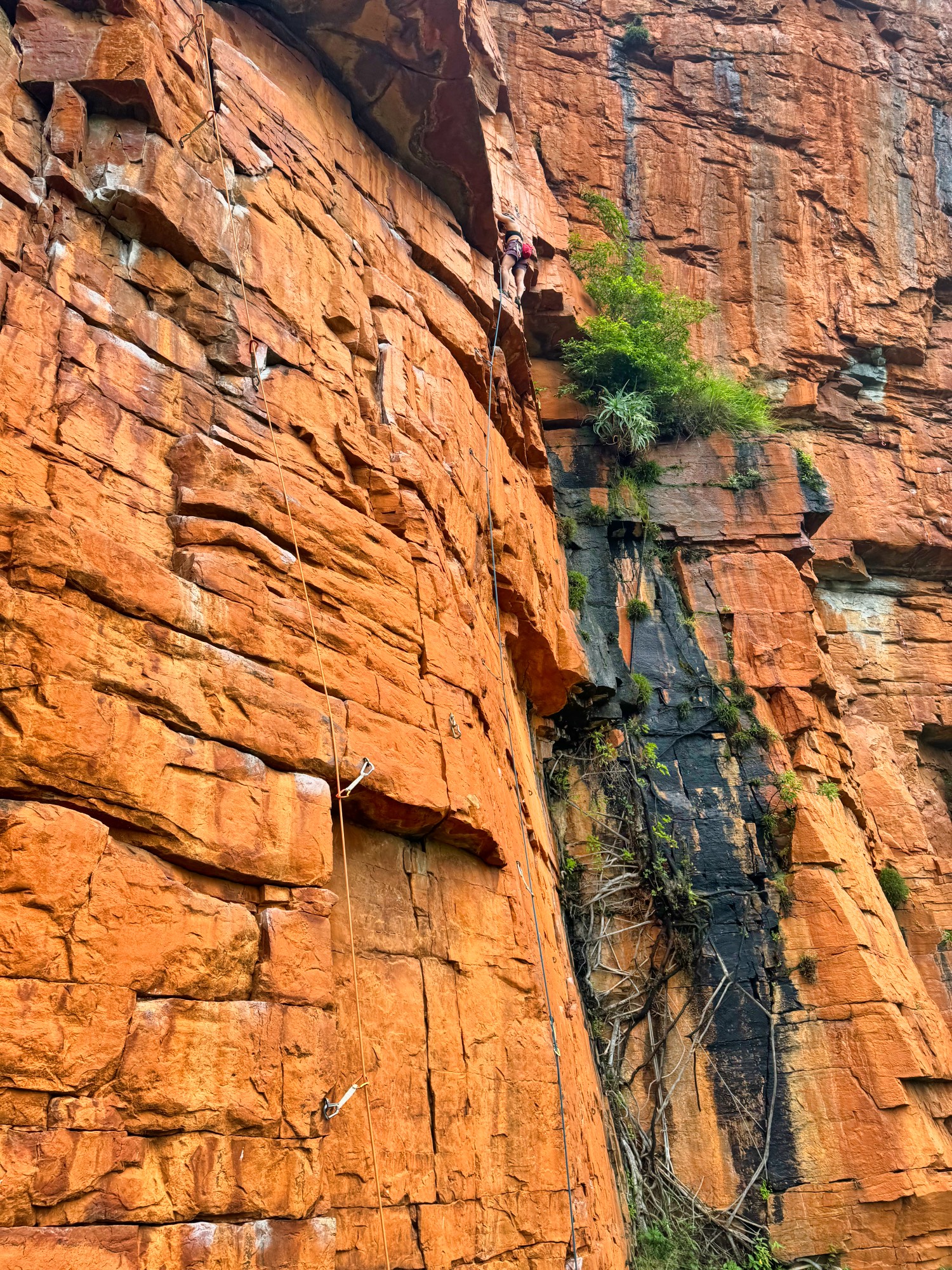
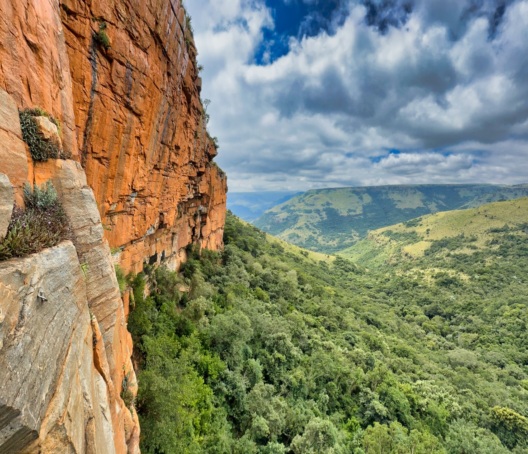
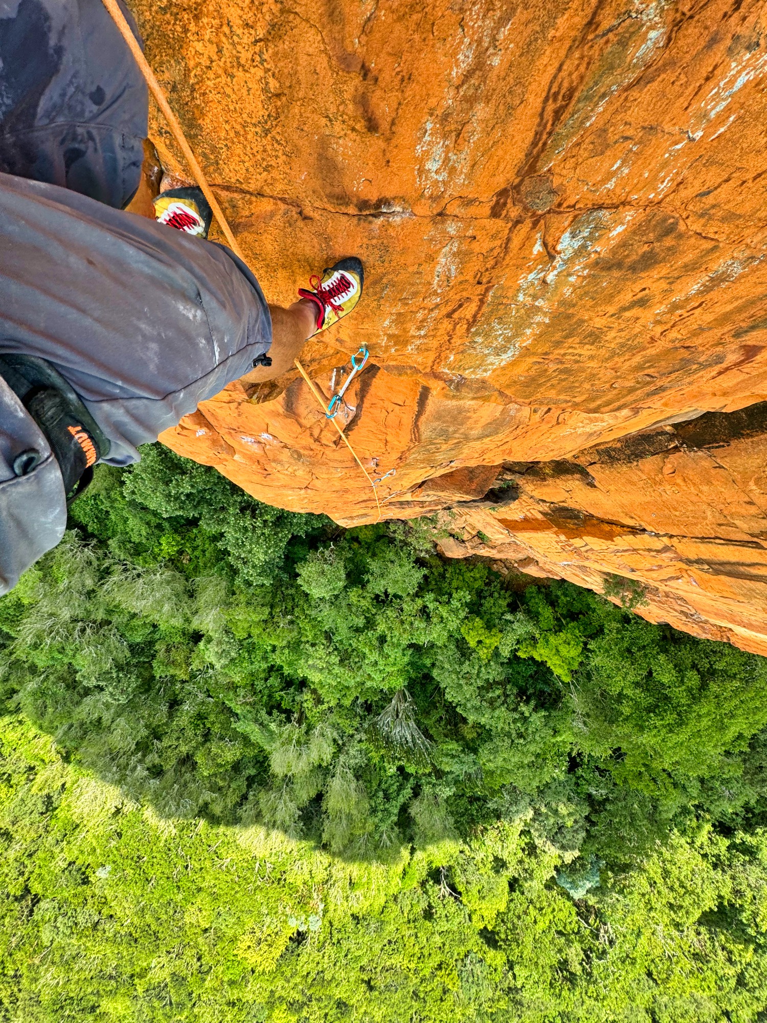
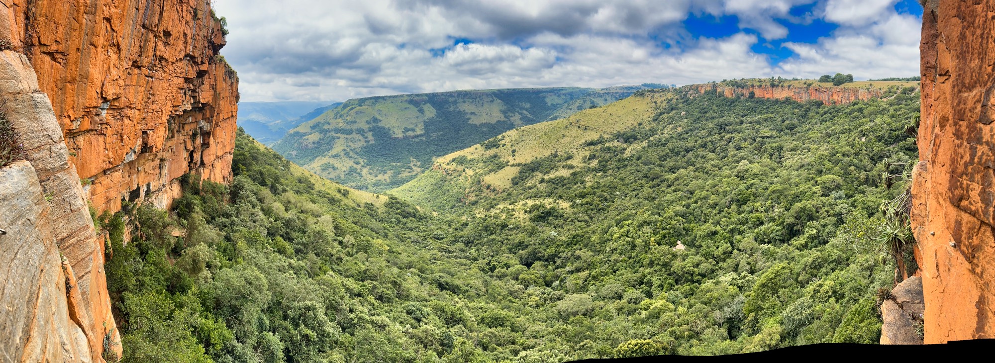
Boven offers around 800 routes (mainly sport) set on the distinctive, orange, and incredibly hard quartzite rock. Their difficulty ranges from 8 to 34 on the local South African grading scale, which corresponds to French 4 to 8c. The length of the routes depends on the sector. Generally, the routes are long – up to 30 and 40 m, and an 80-meter rope is generally a good idea. We only encountered somewhat shorter routes, around 15-20 m, at the Hallucinogenic Wall and The Cove.
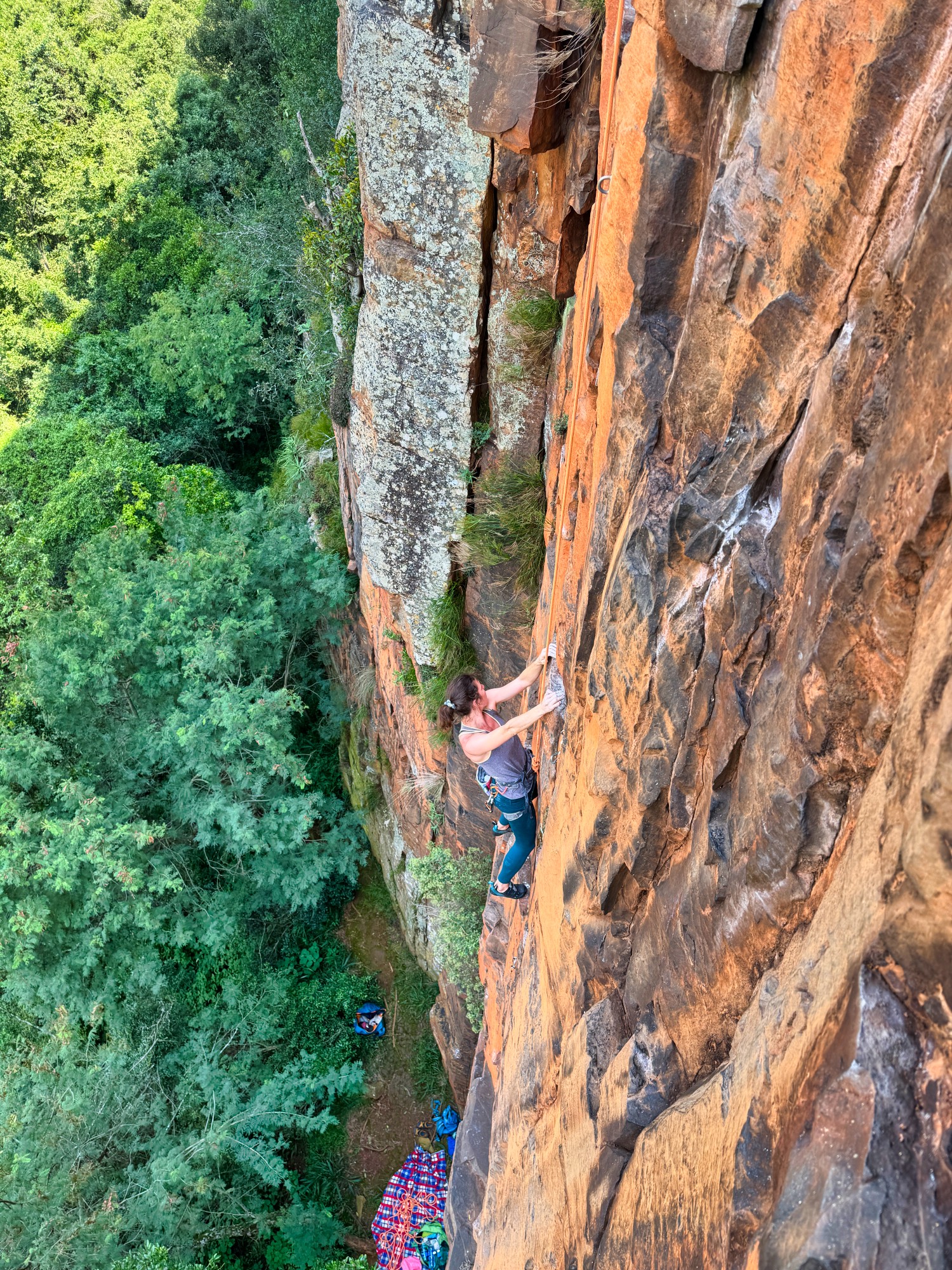
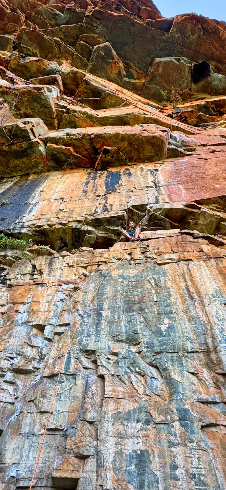
Climbing in Boven somewhat resembles a cross between climbing at Smith Rock and climbing on granite (e.g., in Yosemite or Bohuslän). This is related to the rather characteristic “blocky” structure of the rock in Boven (somewhat like the graphics in “Minecraft”) – the majority of the cracks that form holds and footholds are almost vertical or almost horizontal. Hence, the dominant holds are horizontal edges and horizontal and vertical cracks, or even entire horizontal or vertical rock blocks. The prevailing style on the rock with horizontal edges is akin to Smith Rock climbing – fingers on edges, high feet, standing up and reaching for what may be the next grip. Routes along cracks will certainly appeal to hand-jamming specialists. There are also many routes that combine both styles.
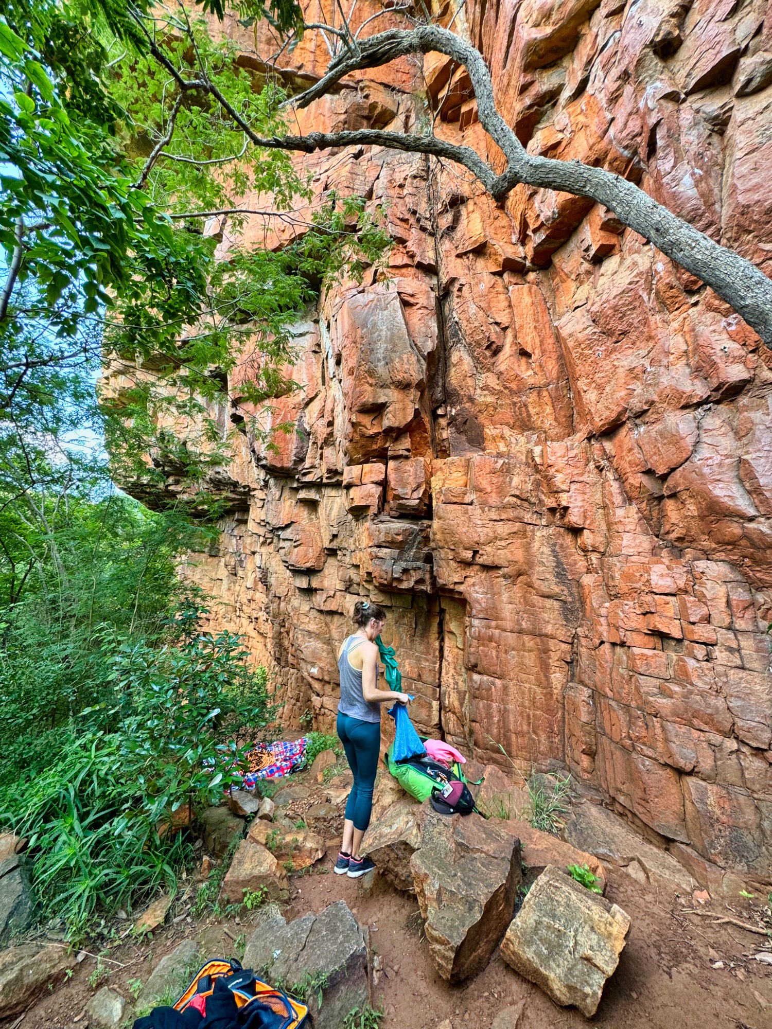
Quite unusual is the way routes are bolted and marked. As a rule, bolting is safe but quite old school. Distances between bolts can range from 2 to even 5 m. Often bolted are also routes that could successfully be climbed traditionally. The way routes are bolted is quite unusual too – bolts on most routes are almost in a straight line, even though the path of the route itself may be more complicated and it can deviate from the line of bolts by up to 2 meters in one direction or the other. Reading the route, finding holds, and deciding where the route leads next are some of the main difficulties of the routes and a skill that must be acquired during a stay in Boven.

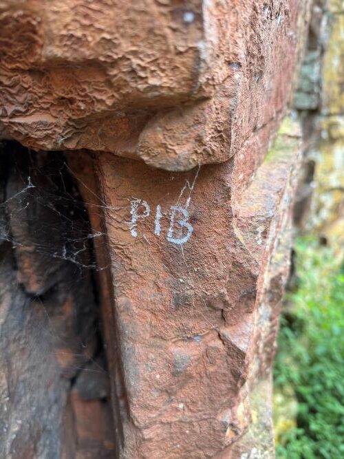
The second issue concerns identifying routes. Unfortunately, there is no good visual guide to Boven, and the only available guide, “A Guide to Climbing for The Restaurant (at The End of the Universe) Waterval Boven, South Africa”, that can be “bought for free” from the website https://www.climbing.co.za/ is a bit outdated – not all routes are described in it, descriptions are verbal, and information about access to sectors and safety is not quite precise. A much better listing of routes as of today is at the Crag, and in most cases observed by us, climbers used this. Also interesting is the way of finding routes – selected routes are described on the rock at the start with the first letters of their names. For example, the route “THE HUFFING WARTHOG” could be marked as “HF” or “THF”, and “Good and Evil” as “GAV”. By the initials, one can find the route in the guidebook or on theCrag, and then count the right or left the appropriate number of undescribed route lines to find the sought-after route (because not all routes are marked and it’s not always easy to find the description – e.g., the route “Endless Summer” has writing so faded, that we walked around this route for 15 minutes before we saw it).
When to Visit
One of the advantages of this place is that it allows for climbing throughout the entire year. The main season is from April to October, when the temperatures are lower, and there is a dry period. We arrived at the turn of February and March, and although the weather was variable, it was possible to climb. Rainfall, along with light storms, occurred almost daily after 3 pm, but they were not too intense, and the rock was suitable for climbing the next day. On days when it rained more, it was possible to climb in overhanging sectors with roofs.
How to Get There
There are three ways to get to Boven. The first is to take a bus, which directly connects Johannesburg airport with Boven – tickets can be booked at https://www.jsltransport.co.za/. Credit cards should be chosen as the payment method, as debit cards pertain to cards issued by South African banks. During booking, it is necessary to provide a phone number, and it is advisable to have WhatsApp installed on it, as the transport company sends information about the connection through this messenger, e.g., confirmation. The journey takes about 4 hours, and the bus departs once a day, around 12:00 noon (thus, it’s a good option if one lands before 9:00 am).
The second option is to rent a car at the airport and drive on your own. From the airport to Boven, there is a convenient but toll highway (cost as of February 2024 is about 200 ZAR), and the driving time is about 3-4 hours. Apart from the highway, the roads are in average condition, and it is advisable to have a car with a slightly higher clearance – we rented a Toyota Starlet, which sufficed for us to reach the parking areas near the Cove and the Restaurant Crag sectors. As of February 2024, there was no possibility to travel to Boven via free roads, as their condition requires the use of 4×4 vehicles, such as, for example, a Toyota Land Cruiser. The condition of the access road to the Waterfall Area and the road connecting Boven with the Wonderland Crags (which is also a free access to Boven) is such that even renting an SUV type car may not be sufficient – there is a significant risk of damage on these roads to any vehicle that is not a real off-road vehicle.
The last option, which we did not try, is to attempt to find a lift through the South African climbers’ forum at https://www.climbing.co.za/. We didn’t try it, but supposedly it works.
Money and SIM cards
In most places such as chain stores, e.g., Usave, or gas stations, international cards can be used for payments. However, it’s good to have some cash on hand because, although common, cards are not accepted everywhere (for example, they cannot be used to pay for the highway) and also tipping is very common. Cash can be easily withdrawn from ATMs, though it involves a small fee (around 50 ZAR). There is one ATM in Boven where you can withdraw a maximum of 2000 ZAR. However, at the Johannesburg airport terminal, after exiting the baggage claim area, there is a Standard Bank on the upper floor that allows for a withdrawal of 7000 ZAR and does not charge a commission (though this may depend on the card).
Although prepaid phone cards are common in South Africa, they are not available to foreigners outside the airport terminal. To buy a SIM card outside the airport, one must show a residence permit. The only option to buy a SIM card is at the airport terminal, and surprisingly, no documents need to be presented. Cards from three companies are available: Vodacom, MTN, and Cell C. Cell C does not work in Boven, while Vodacom and MTN function more or less the same (both networks have coverage in the town) – under some sectors, one network or the other may have coverage. Reportedly, the Telkom network also operates efficiently in the town, but it does not have sales points at the airport, and thus is not available to foreigners.
Topo and Local Logistics
Waterval Boven is situated at an altitude of about 1400 meters above sea level, which we definitely felt after arriving from a climbing area located by the sea. For the first 2-3 days, walking with backpacks was quite tiring.
It’s worth considering that Boven is located in the Southern Hemisphere, so the sun behaves a bit differently than in the Northern Hemisphere. North exposures are the sunny ones, and the sun moves in the opposite direction of the clock hands – it rises in the east, moves to the north, and then sets in the west.
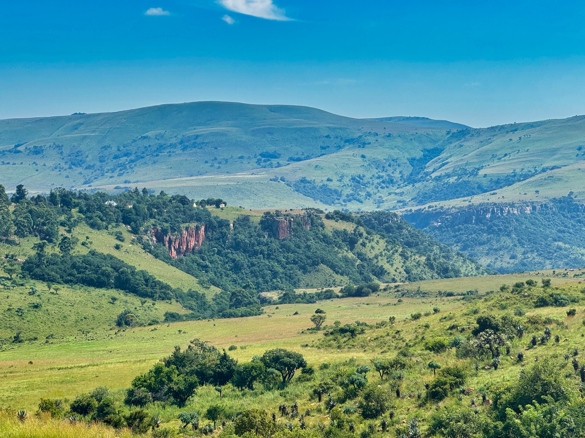
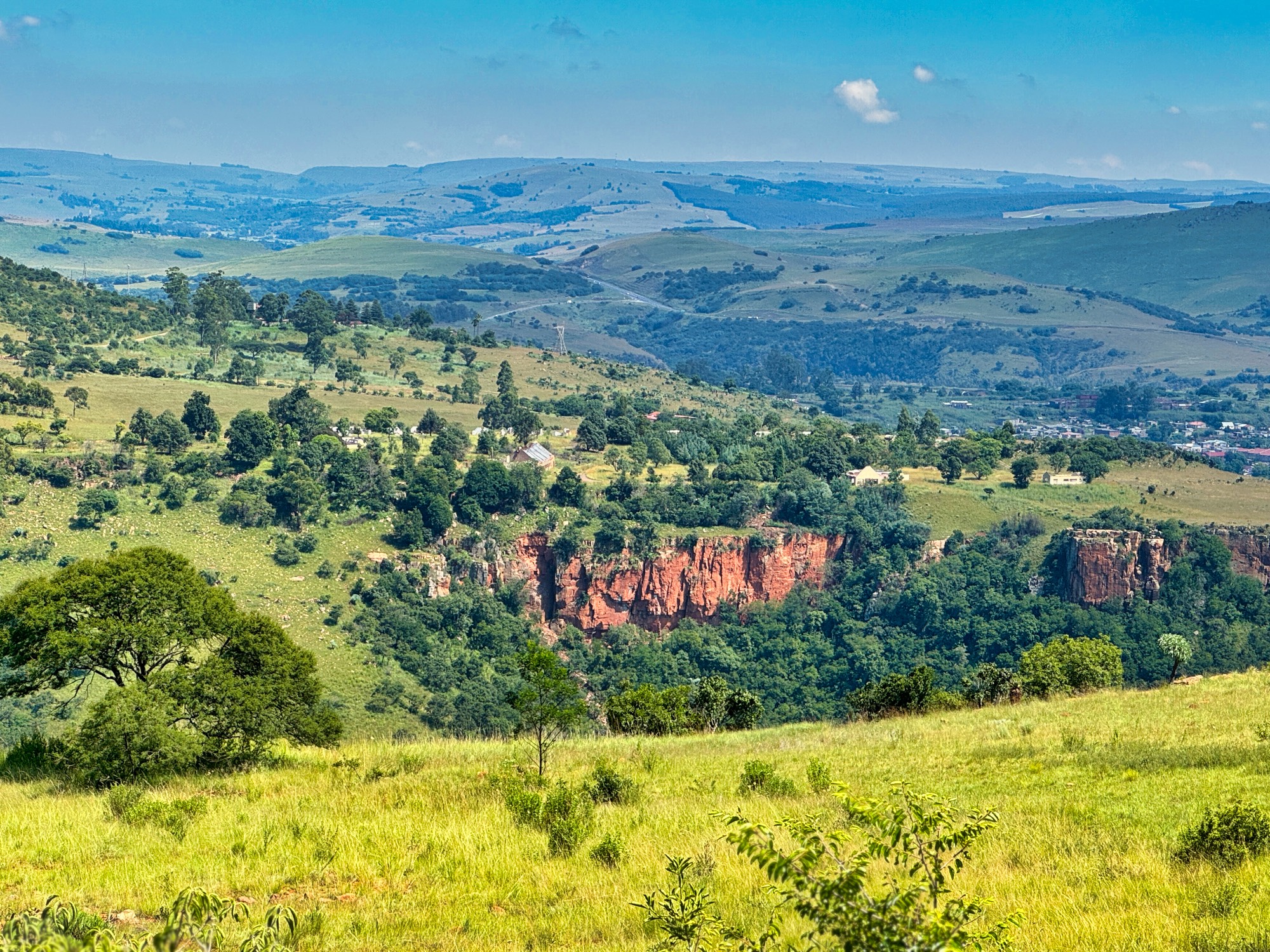
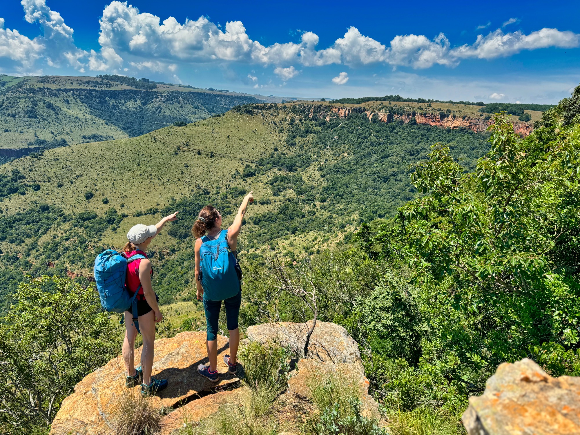
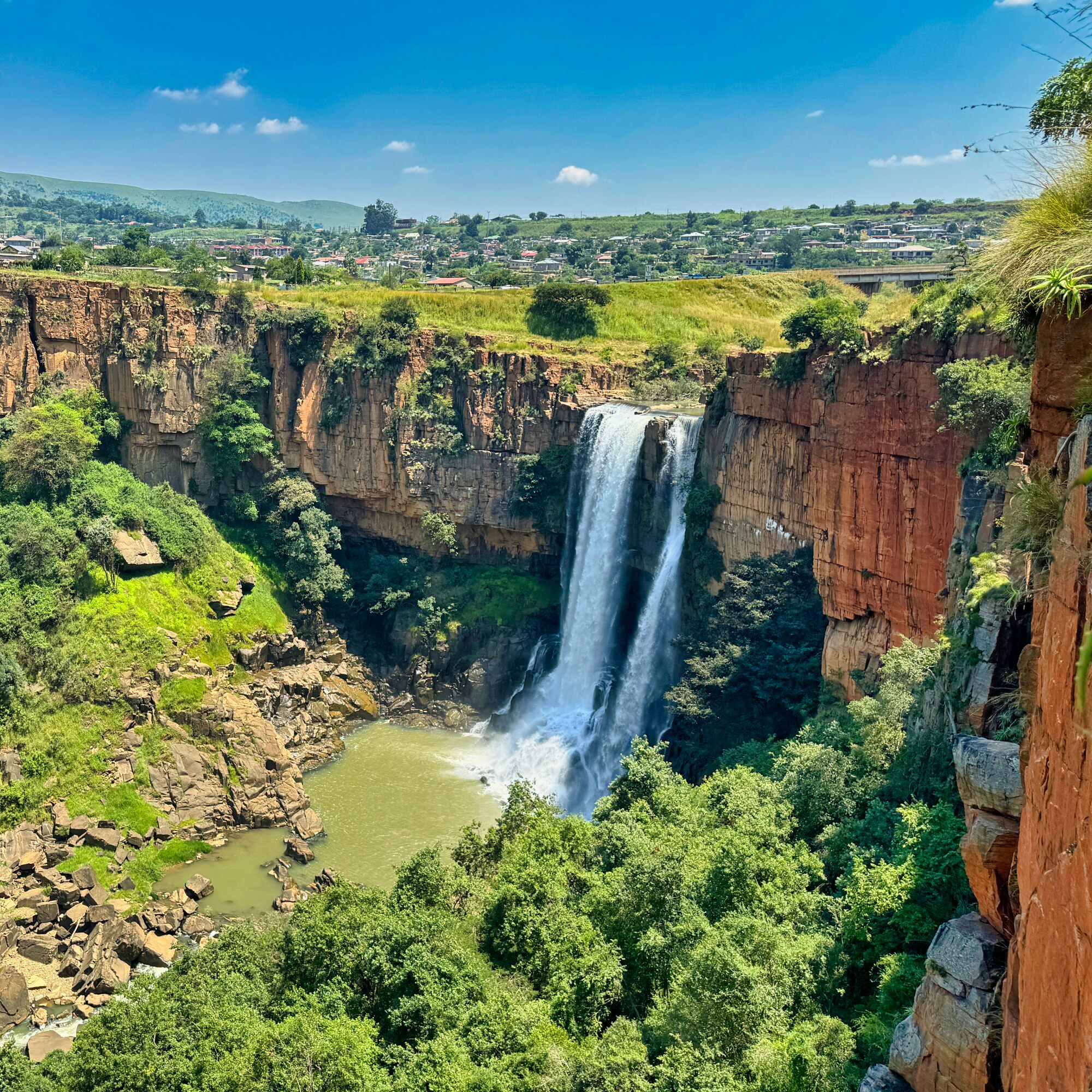
All climbing sectors in Boven are spread over an approximately 10 km stretch, along one large ephemeral cliff, running from the northwest to the southeast, above which the town is located.
There are 4 main groups of climbing sectors:
Waterfall Crags: Located to the northwest, right at the foot of the town, it includes sectors such as the A.C.R.A. wall, WB Wall, and the Last Crag of the Century. Most sectors, except for the ACRA wall, are in the shade all day. Routes here are long and mostly on horizontal edges. We tried Endless Summer and without doubt it was one of the best 6c we have ever experienced.
The Coven and surroundings: Situated about 2 km to the southwest of the town. In this group, there are The Coven, Flying is Fun, and The Other Side. The Coven is in the shade from noon, while The Other Side is sunny for most of the day. The Coven offers only a handful of routes, and they are relatively short, around 15 meters. It is a good introductory place to familiarize oneself with the style of climbing in the area.
The Restaurant Crag and He-man Area: Located about a kilometer further from The Coven, in the southeast direction. This includes The Restaurant Crag, the Gaper Buttress, the Gaper Face, and in the He-man Area: He-man Area, Too Early for the Sky, Meltdown, the Foundry. The Restaurant Crag is in the shade from noon, and the He-man area is sunny for most of the day. We haven’t explored any of the “sunny” crags since they’re best suited for cloudy days, but the Restaurant crag is definitely a great choice for both beginners and advanced climbers. The right side of the crag features both very short and longer, easier routes (up to 6b), while the left side of the crag presents some harder grades.
Wonderland Crags: About 5-7 km away (depending on the starting point) is the largest group of rocks, the Wonderland Crags area, which includes 20 climbing sectors, among them the most well-known are the Superbowl, Hallucinogenic Wall, The God no wall, and the Baboon Buttress. Most sectors on the left side are in the shade in the afternoon, and on the right side in the sun. This place is simply incredible, and by wandering along the cliff, one can discover any type of route they are searching for.
Moreover, there are also smaller or less frequently visited sectors outside the mentioned groups, and their full map can be found at the Crag.
Access to Sectors
An important issue to mention is that Waterval Boven is considered a place of medium safety level. This ambiguous formulation means that during the day, usually nothing bad happens, but cars should be parked only in designated areas – most often at campgrounds, lodges, or on private plots. Leaving a car unattended on the road risks theft or damage. Therefore, there are strictly defined parking locations for each sector.
The best navigation app (both Android and IPhone) is mapy.cz, which allows for offline map use. The app describes the locations of all sectors, country roads, and even approach paths.
The Waterfall Crags sectors are located directly next to a township, a district historically inhabited by poorer residents. This is a relatively unfavorable place to park a car. It’s best to get there by being driven by someone (necessarily in an off-road vehicle) or to park the car near Roc ‘n Rope and then go on foot (30 minutes). The approach to the sectors is not complicated. Follow the main street to the township, turn left, and then proceed to the indicated location (using what3words app) ///concocting.spill.leaked. There, turn onto a bumpy road leading down, cross the concrete bridge over the river, and continue along the road under the highway bridge. At the end of the road, there’s a beautiful viewpoint and the descent stations for the ACRA Wall sector. If aiming for the central sectors (e.g., The Last Crag of the Century), instead of following the road to the end, find a path to the disused railway tracks, which are on the left side of the road (best cross around ///calculate.mantras.nannies). Then, walking along the tracks to the east, towards the tunnel, there are two access options to the central part of the sectors: on foot, by passing through the disused tunnel and turning into the path right behind it, or by performing about a 30-meter rappel from the station, which is about 10 meters to the right before the tunnel. Personally, I find the path more convenient.
The best way to reach The Coven sector is by parking the car on the right side, before the entrance gate to Acra-Retreat Mountain View Lodge (2-3 parking spaces) (What3Words – ///moistening.beans.toffee). Then follow the ephemeral descent path running from the parking lot to the east towards the slope, and then down the slope (the path is visible on Google Maps). About 30 meters after crossing a small stream, the road turns sharply right (what3words ///explanatory.piecework.tactics) and leads down to the base of the wall and climbing sectors – this spot is easy to miss.
The easiest way to get to The Restaurant Crag is by parking at the Tegwaan Country Gateway (the guest area is on the right side before the reception – around w3w ///allowance.constructions.blunders), and then walking along the clear trail, initially heading northwest, then splitting after about 200 meters (go left – ///ability.numbs.unstained). After another 400 meters, the trail splits again (w3w – ///sloppy.expendable.salesclerk), and you should turn sharply left, then cross the stream (preferably barefoot) and follow the path up to The Restaurant Crag.
Access to The Wonderland Crags is somewhat more complicated – there are two ways to reach these areas. The first involves driving a reliable off-road vehicle and parking it on the Tranquilitas property (w3w – ///bravery.tellers.shattered), from where a descent down the gorge follows (w3w – ///square.cherry.forfeit). The second method is to approach on foot, for example, after parking at Tegwaan (see parking location in the access to Retstaurant crag section), to the starting point before the Hallucinogenic Wall (w3w – ///filtration.graceful.sportier). The problem with the first option is due to the tragic condition of the road, which requires a 4×4 drive vehicle. Moreover, Tranquilitas charges climbers a parking fee on their premises, amounting to 60 ZAR per person. According to the local climbing community, it is difficult to determine exactly what these fees are for, as Tranquilitas charges everyone – both people who climb occasionally and local climbers. Additionally, this community suggests that Tranquilitas does not financially contribute to the maintenance or development of nearby climbing areas. I am not aware of Tranquilitas’s position on this matter, but due to the lack of access to a 4×4 vehicle, we opted to approach the Wonderland Crags sectors on foot from Tegwaan.
Where to Stay
In Waterval Boven, there are several accommodation options that can affect the ease of access to the various groups of climbing sectors, depending on whether you have a car and its type.
Firstly, it’s worth mentioning the Climber’s Lodge and Climber’s House offered by Roc ‘n Rope Alex and Gustav (https://rocrope.com/). Both places are next to each other, in the town itself, from where you can walk to the Waterfall Crags in about 30-40 minutes. Access to the other sectors might be slightly less convenient (more details in the logistics section). A major advantage of staying at Roc ‘n Rope is the possibility of receiving care from Alex and Gustav, who are custodians of the entire area and willingly provide assistance, connect individual climbers, and even help in getting to the more difficult to reach sectors that require an off-road vehicle (e.g., Wonderland Crags). Other advantages include the ease of shopping in town and the best internet access.
Other places worth considering are:
- Acra-Retreat Mountain View Lodge, which is close to The Cove sector. This place is located outside of town, so having a car is recommended.
- Tegwaan Country Getaway is another option worth considering. Its undeniable advantage is its direct neighborhood to The Restaurant Crag and its location only 4-5 km from Wonderland Crags, allowing access to the best sectors within an hour.
- Tranquilitas Adventure Farm offers tent pitching and cottage rentals. The main advantage is its proximity to Wonderland Crags, but the downside is the lack of mobile network coverage and the need for an off-road vehicle to reach the place. This site is about 10 km outside of town, which can make stocking up on supplies more challenging.
Living Conditions and Remote Work
During a stay in South Africa, one must contend with certain inconveniences. First and foremost, South Africa struggles with a systemic problem of electricity production, affecting the entire country. In practice, this means planned, almost daily power outages, where each session lasts about 2 hours, with a maximum of 3 such sessions possible per day. The power supply plan is published online and available on the website https://www.ourpower.co.za/areas/emakhazeni/waterval-boven.
From personal experience, I can add that this schedule often changes and is only reliable for the next 24 hours.
Another issue is internet access. The quality of internet in South Africa is variable, and Waterval Boven is no exception. Power outages, rain, or unspecified events affect both the speed and quality of internet access via WiFi and cellular networks. Waterval Boven is definitely not a place friendly for those who would like to work remotely from here, e.g., participating in online meetings or downloading large amounts of data. In the event of a power failure, all local WiFi networks stop working, and the cellular system (both Vodacom and MTN) is overloaded, with significantly reduced speed. We also experienced a complete cellular network shutdown for about 12 hours during a month-long stay. The only option in such a situation is to travel to Milly’s Service Station (w3w: ///necessary.obsessions.explicated), where you can use their good WiFi, which works regardless of power outages (though the trip is associated with a toll road fee).
Boven is not a large town, meaning limited shopping choices and modest supplies. Most needs can be met at the local Usave – offering fruits, vegetables, bread, yogurts – and at the local butcher shop. However, products available at the Usave are of average quality and contain many E additives. Better quality products are available at a larger store in Nelspruit (the new name of the city is Mbombela). An alternative is Spar in Machadodorp (the new name of the city is eNtokozweni), which offers a slightly wider selection. Further travel on the highway towards Johannesburg leads to Milly’s Service Station, where Milly’s shop offers a good selection of local products such as pies, coffee, honey, and other preserves. However, it’s important to remember that the only option to travel from Boven to Machadodorp is the highway, and there is a toll gate between these locations. This means that every trip, whether for shopping or for internet access at Milly’s, is associated with a fee of about 110 ZAR (220 ZAR for a round trip).


